
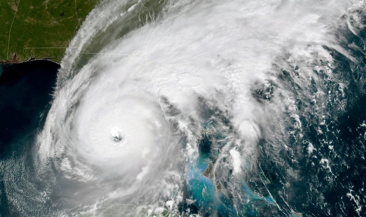
NOAA has maintained its forecast of a below-normal Atlantic hurricane season — about a 75% chance of below-normal activity, with El Niño expected to develop and strengthen. Meanwhile the National Hurricane Center has been issuing advisories on Tropical Storm Edouard in the northern Gulf, and September is the climatological peak of the season.
Those facts sit together uncomfortably in a headline and not at all uncomfortably in reality. Understanding why is the difference between a seasonal forecast being useful to you and being actively misleading.
What a seasonal outlook actually forecasts
| It forecasts | It does not forecast |
|---|---|
| How many named storms form in the whole Atlantic basin | Where any of them go |
| How many become hurricanes | Whether any make landfall |
| A range, months in advance | Anything about your address |
A seasonal outlook is a statement about an ocean. Landfall depends on steering currents that do not exist yet when the forecast is issued and cannot be predicted months ahead.
The example that settles the argument: 1992. That Atlantic season was well below normal by storm count — a quiet year by every seasonal measure. It produced Hurricane Andrew, which struck South Florida as one of the most destructive hurricanes in United States history. The seasonal forecast was not wrong. It simply answered a different question from the one that mattered to the people in its path. It takes one storm, and the count does not care where it goes.
Why El Niño suppresses Atlantic storms
The mechanism is worth knowing because it explains what the forecast is confident about and what it is not.
El Niño warms the eastern Pacific, which strengthens upper-level winds over the Atlantic. Strong winds at altitude tear at a developing storm’s structure — wind shear — and a storm that cannot organise vertically does not intensify.
So El Niño makes it harder for storms to form and strengthen. It does nothing whatsoever to steer the ones that manage it away from land.
September
The Atlantic season runs 1 June to 30 November, but the activity is not spread evenly across it. It concentrates sharply around the middle of September, when ocean heat is at its maximum and the atmosphere is most favourable.
A below-normal season still has its peak in the same place. Fewer storms, same weeks.
What is actually worth acting on
- Watches and warnings for your location. These arrive days ahead and are specific to you. This is the only forecast that should change your behaviour.
- Knowing your evacuation zone before there is a reason to. Every coastal county publishes them, and looking it up takes two minutes on a calm day.
- Flood insurance timing. Policies typically have a waiting period before they take effect, so buying one with a storm approaching does not help.
- Ignoring the seasonal number. It is genuinely useful — to insurers and emergency planners allocating resources across a region. It is not a household planning tool.
The honest summary
A below-normal forecast means the basin will probably produce fewer storms than usual. It is not a forecast that you will be spared, because it was never trying to be one.
The people who got that wrong in 1992 were not being careless. They were reading a number that looked reassuring and did not describe them.
NOAA has maintained a forecast of a below-normal 2026 Atlantic hurricane season, with a stated 75% chance of below-normal activity, 20% near-normal and approximately 5% above-normal, attributed largely to the expected development and intensification of El Nino, as published in its seasonal outlook and news releases. The National Hurricane Center has been issuing advisories on Tropical Storm Edouard in the northern Gulf and indicated that no further tropical cyclone formation was expected over the subsequent seven days. The Atlantic hurricane season runs from 1 June to 30 November with activity peaking around mid-September. The 1992 Atlantic season is widely documented as below normal by storm count and produced Hurricane Andrew. Conditions change rapidly; the National Hurricane Center at nhc.noaa.gov and local emergency management authorities are the authoritative sources for current watches, warnings and evacuation instructions, and their guidance takes precedence over anything in this article.
Frequently Asked Questions (FAQ)
What is NOAA forecasting for the 2026 season?
A below-normal Atlantic season: a 75% chance of below-normal activity, 20% near-normal and about 5% above-normal, with the outlook attributing the expectation largely to El Nino developing and strengthening during the season.
Is there a storm right now?
The National Hurricane Center has been issuing advisories on Tropical Storm Edouard in the northern Gulf, while indicating that no further tropical cyclone formation was expected over the following seven days.
Does a below-normal season mean I am safe?
No. A seasonal outlook forecasts how many storms form across the whole Atlantic basin. It does not forecast where any of them go. A quiet season with one landfall near you is worse for you than a busy season that stays at sea.
Has a quiet season produced a major disaster before?
Yes. The 1992 Atlantic season was well below normal by storm count, and it produced Hurricane Andrew, one of the most destructive hurricanes ever to strike the United States.
When is the peak of the season?
Around the middle of September. The Atlantic season runs from 1 June to 30 November, but activity concentrates heavily around the peak.
What should I actually do with a seasonal forecast?
Very little. It is useful to emergency managers and insurers planning across a whole region. For a household, the actionable information is a watch or warning for your specific location, which comes days before an event, not months.